Yes, you can camp for free in national forests and national grasslands throughout the United States. In fact, all national forests and grasslands allow for free camping and boondocking. But they don’t allow you to do so anywhere you want.
Can You Camp for Free in National Forests?
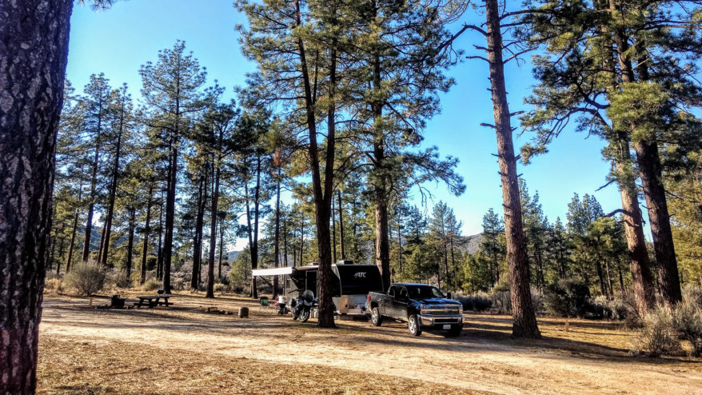
Every national forest within the U.S. Forest Service allows for free camping and boondocking. “Dispersed camping” is the official term the USFS uses to describe boondocking. Additionally, each forest will also have a limited number of developed campgrounds available for free camping as well.
Each forest and grassland maintains a general policy of allowing dispersed camping. However, they don’t allow dispersed camping everywhere within their boundaries. Most forests maintain “wilderness areas” which are limited to just tent camping only. Some forests have rules that prohibit dispersed camping within close proximity to developed campgrounds.
The only way to know what the rules are for any given forest or grassland is to inquire at a visitor center or ranger station.
How to Find Dispersed Camping in National Forests
Generally speaking, free, dispersed camping is allowed wherever you find a forest road.
But the important question is, how far from the side of the road are you allowed to set up camp?
The answer to that question is found in the Motor Vehicle Use Map (MVUM). Each forest and grassland publishes its own MVUM, which is considered to be a legal document containing a map of the entire forest, depicting every road and highway, and is geographically accurate down to GPS coordinates. There will always be a table of road numbers indicating where dispersed camping is permitted from, and how many feet from the center-line of the road you are allowed to set up camp. The MVUM also tells you which roads are open to non-street legal vehicles, and which roads are not. For more about MVUMs see, “How to Use Motor Vehicle Use Maps to Find Free Camping“.
Each Forest Will Close Down Dispersed Camping Temporarily in Certain Areas
A forest will frequently close down dispersed camping in isolated areas due to a variety of reasons. Fire prevention, muddy roads, maintenance crews, will often cause portions of forests to be closed down for camping.
The only way to know about these temporary closures is visit that forest’s official website (found from here) and check for, “Alerts & Notices” on the side bar.
Each Forest Will Offer Some Developed Campgrounds For Free
These developed campgrounds are all primitive in nature, meaning no hookups, and are usually packed with campers on weekends. The only way to find out about them is to visit that forest’s official website and go through their list of developed campgrounds and review each of them, one by one. They don’t make it easy to find the free campgrounds.
You can also just call the forest’s official headquarters and ask.
Wilderness Areas Are Off-Limits to Vehicles
Almost every forest and grassland has set aside a portion of acreage they deem to be “wilderness”. The term “wilderness” is used to describe an area that meets the criteria established by the Wilderness Act of 1964. Each forest’s official website will list these wilderness areas usually under the side menu labeled, “Special Areas”.
You are still allowed to camp for free wilderness areas, anywhere you want. You just can’t drive a vehicle into these areas. You must hike your camping gear in.
Do Not Trust Google Maps to Find Forest Boundaries
Google Maps does not depict official boundaries of a national forest or grassland. Rather, it depicts the larger sphere of influence. If you rely on Google Maps to find forest boundaries, you will very likely end up camping on someone’s private property.
Each forest and grassland is riddled with small plots of privately owned land. These plots are called “inholdings“. Only the Motor Vehicle Use Map (MVUM), see above, will show you the official boundaries. You can also rely on our own national forest map to find boundaries.