Dispersed camping near Flagstaff, AZ is plentiful due to the city’s close proximity to Coconino National Forest. In fact, it’s completely surrounded by national forest. Flagstaff remains a popular choice for dispersed camping and boondocking because of its high altitude (6,000-7,000 feet) and cooler temperatures in summer.
Dispersed Camping Near Flagstaff, AZ
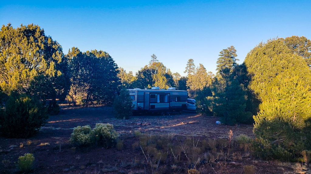
All camping areas listed below were recommended by our own experiences camping there and based on popularity with other boondockers…
Fort Valley Dispersed Area (GPS 35.2501, -111.6886) – 5.1 miles to Flagstaff – The closest to town of all the camping areas listed here, this is popular dispersed camping area due to its proximity to Flagstaff. Like most places in Coconino National Forest, it remains closed during Winter and early Spring. Otherwise, it’s easy access for most vehicles. It’s also a popular hiking area.
Friedlein Prairie Dispersed Area (GPS 35.2935, -111.7029) – 10.2 miles to Flagstaff – Forest Road 522 branches off of Snow Bowl Road and takes you into area of numbered campsites. The sites are pretty well spaced apart. There are only 15 numbered camping sites. However, these sites tend to be small, able to accommodate cars, vans, and small RVs. Medium to large sized RVs will find difficultly trying to turn around.
Lower Lake Mary Dispersed Area (GPS 35.105, -111.595) – 10.3 miles to Flagstaff – The usually dry Lake Mary is more known for its day-use picnic area, however there is a lot of dispersed camping to the south-west, along an unnamed dirt road that branches off of NF-132. This unnamed dirt road can be bumpy, but still driveable for 2WD vehicles.
Walnut Canyon National Monument (GPS 35.1783, -111.4974) – 11.3 miles to Flagstaff – The only camping area listed here that belongs to the National Park Service, Walnut Canyon offers free, dispersed camping up to 14 days. What makes this place unique is that Walnut Canyon is home to ancient Anasazi Indian ruins that you can hike to. The dispersed camping area begins on the west side of S. Cosnino Rd (County Road 622).
Pumphouse Wash Dispersed Area (GPS 35.0536, -111.7322) – 12.7 miles to Flagstaff – FR-237 branches off of AZ-89A about 17 miles north of Sedona and takes you into an area known as Pumphouse Wash. This area was specifically designated by Coconino National Forest for dispersed camping, though it does close up during Winter and early Spring due to snow and mud. Dispersed camping is allowed only in one of four areas, and only in sites marked by a brown post. Please see Official Camping Guidelines for Pumphouse Wash.
Forest Road 171 Dispersed Area (GPS 35.2614, -111.8324) – 13.4 miles to Flagstaff – This is wide flat area often referred to as “Camp Z Tank” on other maps. While this area is large enough to accommodate hundreds of RVs, most usually go camping along outer edges, near the trees. The road in is easy for any vehicle, and the area is suitable for the largest sized rigs.
Marshall Lake Dispersed Area (GPS 35.1123, -111.5384) – 14.3 miles to Flagstaff – Don’t let the name fool you, Marshall Lake is more of a marsh than a lake. It’s not great for fishing or boating, but good for bird watching. The camping area is huge, able to accommodate 40-50 cars, vans, and RVs. The road in, however, is bumpy and rutted, but shouldn’t be a problem for high clearance vehicles.
Willard Springs Dispersed Area (GPS 34.9755, -111.6950) – 17.5 miles to Flagstaff – South along I-17, Forest Road 253 branches off as Exit 326 (Willard Springs Road) and heads south until it turns west. There are several dispersed campsites here, but you can camp anywhere along this road further up. The road remains well-graded and easy to drive.
Schnebly Hill Road (GPS 34.9055, -111.6459) – 22.4 miles to Flagstaff – Though it’s the furthest away from Flagstaff, this area is one of the most popular for its large area, numerous camping sites, and for its heavy OHV use. Schnebly Hill Road will also take into Sedona and lead you to some gorgeous hikes and view points.
The Fort Valley Dispersed Area shown above is no longer allowed for camping. Please remove this from your site.
A map do not have gps