Dispersed camping near Zion National Park is plentiful due to the abundance of surrounding BLM lands. You can find dispersed camping, boondocking, and free camping just minutes away from the park entrance. Below are our recommendations for dispersed camping.
Note: the following camping areas were recommended based on our own experiences camping there or based on popularity with other boondockers.
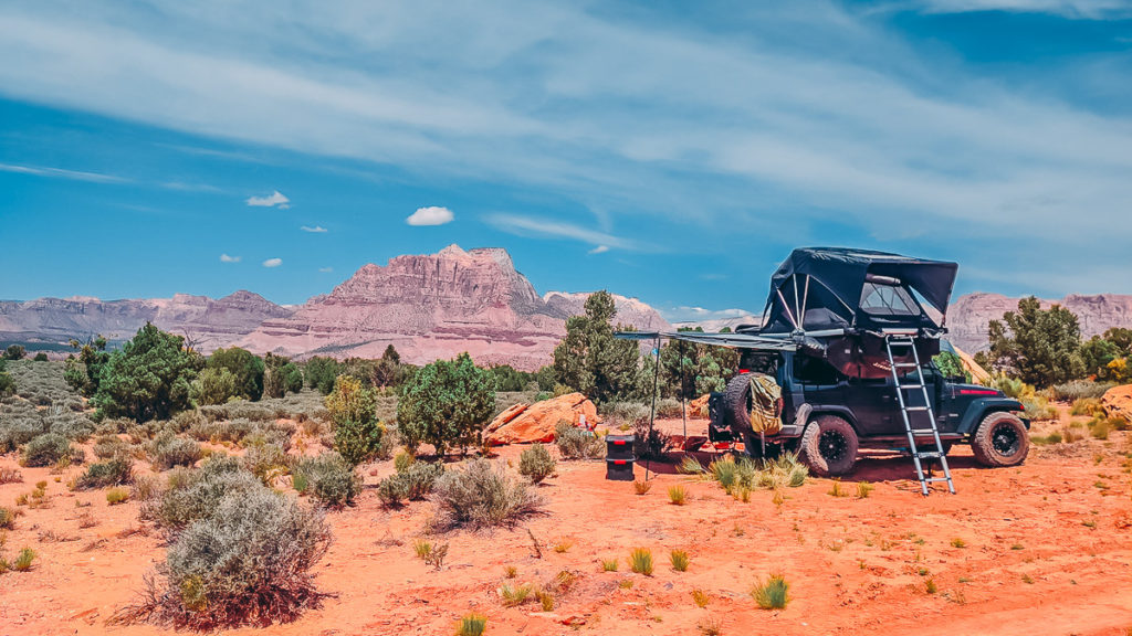
Dispersed Camping Near Zion National Park
Campsites listed below are all located on BLM lands, and are free to camp. They all have a maximum of 14 days stay…
Poverty Kiosk OHV Staging Area (GPS: 37.23631, -112.81356) – 4.5 miles to Park entrance – This is primarily a staging area for OHV trail riders. However, during the week it’s not that crowded or noisy. The camping area is small, perhaps accommodating a 4-5 large RVs, or 5-10 smaller vehicles. See Poverty Kiosk OHV Staging Area Camping Map.
Smithsonian Butte Road (GPS: 37.15154, -113.05902) – 6.2 miles to Park entrance – Very popular camping for folks with SUVs and vans, there is no camping allowed on Smithsonian Butte Road itself. Instead, you are required to camp at least 1/2 mile away from the road. We recommend entering this area from the south, through the town of Apple Valley, otherwise the northern approach is more rocky, and requires passing along low clearance bridge (13’4″) over Virgin River. See Smithsonian Butte Road Camping Map.
Zion Scenic Byway Dispersed Area (GPS: 37.25501, -112.76883) – 8.0 miles to Park entrance – This area offers more campsites than Poverty Kiosk while keeping your relatively close to Zion’s east entrance. The scenery offers beautiful landscapes, and the access road is suitable for most RVs and vehicles. See Zion Scenic Byway Dispersed Area Map.
Gooseberry Mesa (GPS: 37.14853, -113.16022) – 14.0 miles to Park entrance – Another popular area for mountain bike riders, Gooseberry Mesa offers lots of camping sites with minimal rules on where you can and cannot camp. However, the access road into here is very bumpy and washboarded. It’s best suited for vans and SUVs. See Gooseberry Mesa Camping Map.
North Creek Dispersed Area (GPS: 37.22033, -113.16166) – 15.1 miles to Park entrance – What makes this camping area popular is that most of it is accessed via hard-packed gravel (Kolob Terrace Rd) and easily driven by any vehicle. However the spur roads leading into individual campsites are heavily rutted and dipped. Also, this area can get crowded because the camping area is small and sites are closer together. See North Creek Dispersed Area Camping Map.
Hurricane Cliffs Recreation Area (GPS: 37.20497, -113.23300) – 16.7 miles to Park entrance – this area includes 56 numbered primitive campsites, managed by Utah BLM, St. George Field Office. You are required to camp in one of the numbered sites. There are no reservations, and no fees. Most sites include a fire ring. See Hurricane Cliffs Camping Map.
Dalton Wash Road (GPS: 37.22713, -113.11446) – 17.0 miles to Park entrance – This area doubles as the very popular “Guacamole Trailhead”, frequented by mountain bike riders. The downside to camping here is that flying insects are a problem. Just remember to bring your favorite bug repellent. See Dalton Wash Road Camping Map.
It would be helpful to say which side of the park each site is so I don’t need to hunt down every one to find one near the East entrance.
@ Todd Swagerty they included these sick new things called GPS coordinates. In 30 seconds I knew where every location was
@Todd — yea, how dare you have to do any sort of research yourself….
I’m here to defend Todd from those little nebbishes above me. Asking for slightly more convenience from a free camping guide isn’t that bad, actually.