There are a lot of places where you can camp for free in Arizona. Arizona has so much public land spread out across numerous state and federal agencies that it’s very easy to find places to camp for free. Here’s our list of 25 places to camp for free in Arizona.
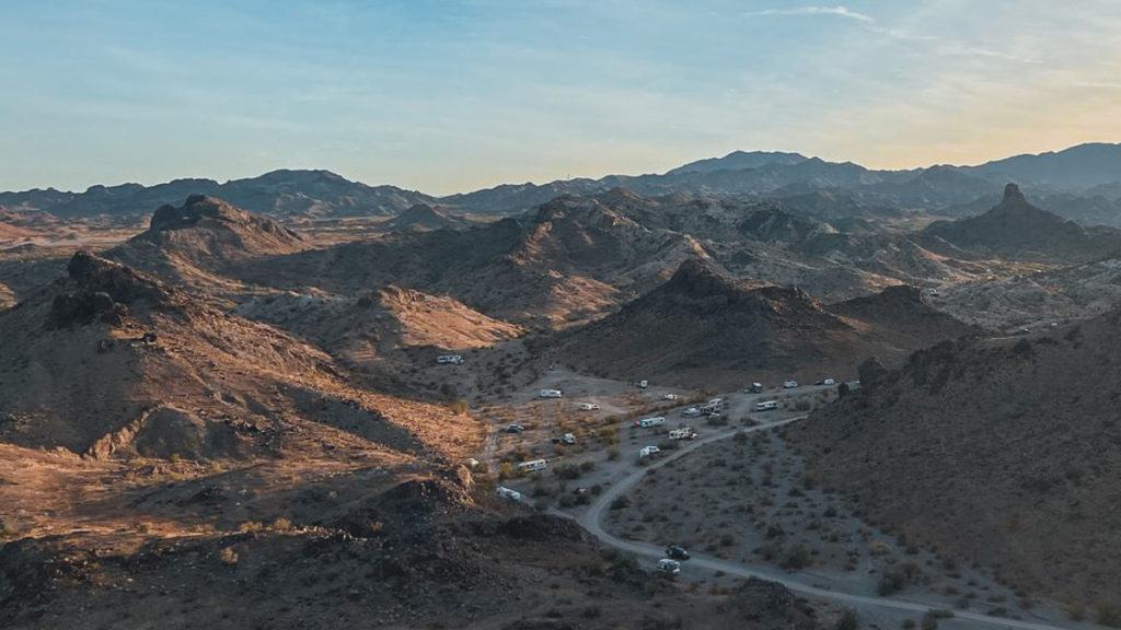
Craggy Wash, Arizona, Bureau of Land Management, Photo by summerfunspirit621, FreeRoam
Where Can You Camp For Free in Arizona?
Below is our top 25 places to camp for free in Arizona based on our experiences camping here ourselves and based on popularity with other boondockers…
Bureau of Land Management
Craggy Wash – Located along AZ-95, about 8 miles north of Lake Havasu City’s center, this area offers easy access along a packed dirt road, though gets bumpy and sandy the further you go in. You’ll find plenty of clearings to camp on. During the height of the winter camping season it fills up with snowbirds. Pros: lots of camp sites to choose from, close to Lake Havasu City for supplies, decent Verizon and AT&T signal. Cons: Busy area, can get noisy on weekends with OHVs, weak T-Mobile & Sprint signal.
Dome Rock Road – This is one of several areas in the Quartzsite area. Dome Rock Road runs west of town and is just as busy during the height of Arizona’s snowbird season. Lots of free areas to camp in, and roads are mostly hard-packed. Verizon & AT&T signal comes in great, and it’s just a 5 minute drive into town. Pros: Close to town, good cell signal, good views of sunsets. Cons: crowded in winter, can get filled with trash, noise from nearby I-10.
Gunsight Wash – Located about 10 miles south of Ajo, AZ, along AZ-85, this area offers lots of campsites along with close access to Organ Pipe National Monument. Areas closer to the highway have hard-packed gravel, but the roads get soft the further in. Pros: Close to town for supplies, right on the border with Organ Pipe National Monument, good Verizon, AT&T, and T-Mobile. Cons: Can get crowded during winter snowbird season, mice and scorpions can be a problem.
Smuggler’s Run – Located just south of I-8, along Vekol Valley Rd (Exit 144), you head south into a corridor that had once been used to smuggle illegal aliens up from Mexico. While signs are posted warning of smuggling activity, it’s rare to see any activity at all. Today, it’s mostly boondockers that you’ll find. Pros: easy access into the area, good cell signal from all carriers. Cons: far from town.
Indian Bread Rocks – Named for a boulder shaped like Indian bread, this location is the entrance into Dos Cabezas Mountains Wilderness, in the south-eastern part of the state. There are picnic tables here, and lots of choices for free camping. Vehicles are not allowed into the Wilderness, but are allowed at Indian Bread Rocks. Pros: lots of sites to choose from, great hiking opportunities, close to town. Cons: lots of cattle roam here, roads can be narrow and difficult to turn around for long rigs.
Badger Canyon – Located in the north-west part of the state, this is a perch overlooking the Colorado River near Vermilion Cliffs and the City of Page. The road in is more bumpy; low clearance vehicles may struggle. However, you get gorgeous views of canyons. Pros: great views, good star gazing. Cons: Useable Verizon signal, weak signal for all other carriers, bumpy road in.
Saddle Mountain – Located about 10 miles west of Buckeye along the south side of I-10. A dirt road starts from W. Courthouse Rd, and runs towards the mountain. There are numerous clearings along this dirt road, all on BLM land. A popular area for winter snowbirds because of its closeness to Buckeye and the greater Phoenix area. Pros: good cell signal, lots of sites to choose from, great sunsets. Cons: can get crowded, OHV noise on weekends, flying insects can be bothersome. (read more about Saddle Mountain).
Old Airstrip – Located just north of Lake Pleasant Regional Park, this is an old landing strip that has since been taken over by OHV riders and campers. What makes this unique is the abundance of wild burros that come right up to your camp. The road in can be bumpy, and there are several steep grades that might be troublesome for weaker trucks towing heavier trailers. However, dozens of RVs are here throughout the week. Pros: wild burros, lots of sites to choose from. Cons: cell signal can be spotty, OHV noise on weekends.
Ironwood Forest National Monument – Located north-west of Tucson, this is a BLM managed area with numerous roads and possibilities for free camping. You will be surrounded by tall saguaro cactus and brushy mesquite trees. Beautiful sunsets to be seen here. Pros: Verizon & AT&T comes in strong, relative proximity to town, lots of campsites to choose from. Cons: Some roads require high clearance vehicles, flying insects can be bothersome, noise from OHV riders.
Kofa National Wildlife Refuge
King Road – The main artery through Kofa NWR, you are allowed to camp anywhere along this road, as well as spur roads that branch off of it. Kofa NWR lies in the south-west portion of the state, with the City of Yuma as the closest big town. It fills with campers during the winter snowbird season and offers great views of wildlife. Pros: decent Verizon signal, views of wildlife and rock formations. Cons: far from town, weak cell signal from AT&T, T-Mobile, and Sprint. (read more about Kofa National Wildlife Refuge)
Buenos Aires National Wildlife Refuge
83 Designated Campsites – Located on the border with Mexico, south-west of Tucson, there are 83 marked campsites within Buenos Aires NWR. Most of these are easy to get to with street-legal vehicles. Cell signal here is almost non-existent. However, you can enjoy more secluded camping here and views of wildlife. Pros: secluded camping, mostly easy access roads, views of wildlife. Cons: far from town, poor cell signal. (read more about Buenos Aires National Wildlife Refuge).
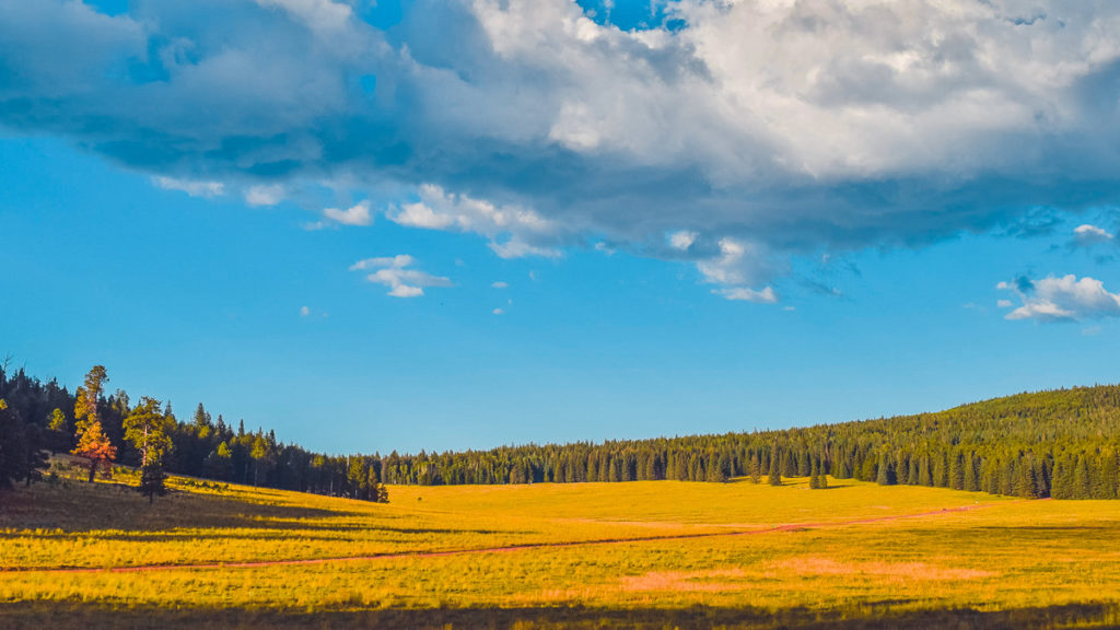
Greens Peak, Apache-Sitgreaves National Forest, Arizona, photo by nicolextine, FreeRoam
Apache-Sitgreaves National Forest
Strayhorse Campground – This is technically a developed campground with picnic tables and grills, but has no fees. It is set among large Ponderosa Pine and Gambel Oak. Just six miles below the Mogollon Rim, it provides a cool shady site for picnics or camping. Pros: Lots of solitude, very few people camp here, shady. Cons: far from town, very little cell service.
Greens Peak – Located in the northern part of the Forest, along Forest Road 61, you’ll enjoy lots of seclusion, and maybe enough get in some naked camping too. It’s located where a large flat plain of ground scrub meets a bank of tall pines at high elevation. Pros: lots of seclusion, wildlife spottings, a more pristine environment. Cons: Far from town, almost no cell service.
Coconino National Forest
Schnebly Hill Road – Located just 20 minutes south of Flagstaff, along I-17, Schnebly Hill Road offers numerous dispersed camping sites under tall, old growth pines. It’s usually closed during the colder part of the year, but opens up around April. It’s also popular with OHV riders, so expect to hear a lot of noise on weekends. Pros: close to Flagstaff for amenities, good cell signal right off I-17, plenty of shade. Cons: Lots of noise from OHV riders on weekends. (read more about Schnebly Hill Road).
Forest Road 237 – Located about 20 minutes north of Sedona along AZ-89A, this is the official dispersed camping area for the Sedona area. There are dozens of campsites here shaded by tall pines. It can get pretty crowded on weekends, so your best bet is to arrive mid-week to secure a site. Pros: decent cell signal for Verizon & AT&T, shaded campsites, close to Sedona. Cons: crowded on weekends. (read more about Forest Road 237).
Walnut Canyon Dispersed Area – Walnut Canyon remains a popular camping area for locals in the Flagstaff area. This dispersed area offers dozens of campsites on hard packed dirt roads. It’s popular for its ease of driving access and proximity to town. Pros: close to Flagstaff, easy access, decent cell signal from AT&T and T-Mobile. Cons: Crowded on weekends.
Coronado National Forest
Proctor Campground – Located in the deep south of the State, Proctor Campground takes you far from town into a small, dispersed camping area. The road in is bumpy, but worth it if you want to enjoy some star gazing. It can get crowded during the winter camping season. Pros: good star gazing opportunity, decent Verizon signal. Cons: far from town, crowded during winter.
Incinerator Ridge Road – Located up on Mt. Lemmon, just outside of Tucson, AZ, this is a dispersed camping area that offers a handful of sites. Your best bet is to get here during mid-week, otherwise weekend arrivals will find themselves shut out. Pros: beautiful views of Mt. Lemmon, cooler temps in summer, decent Verizon cell signal. Cons: busy on weekends, poor cell signal for all carriers except for Verizon.
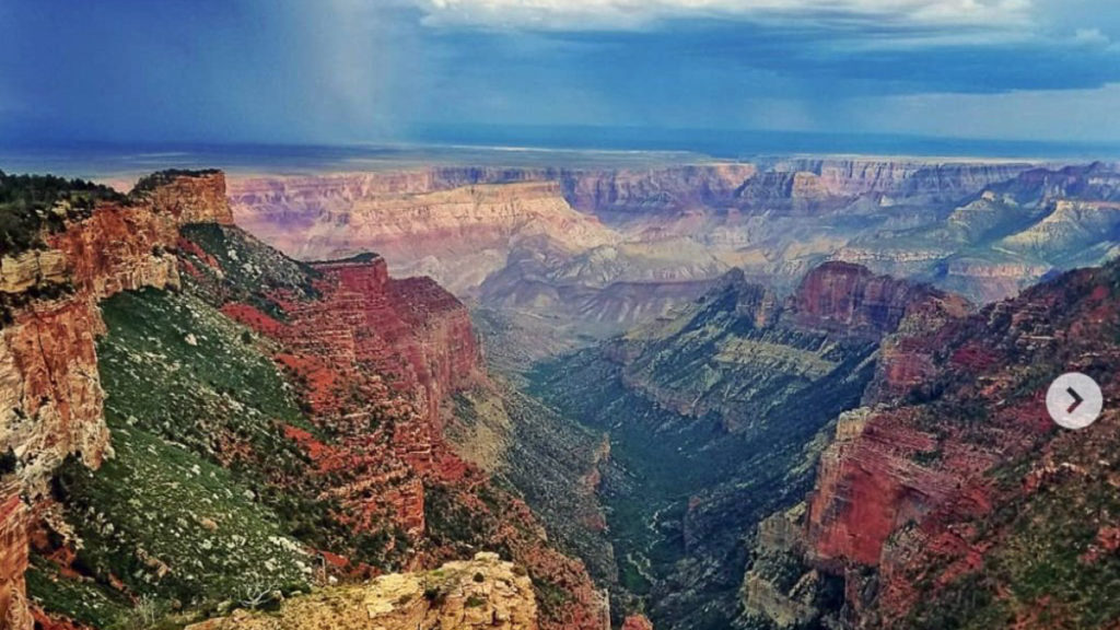
Saddle Mountain Overlook, Kaibab National Forest, Arizona, photo by kylestack666, FreeRoam
Kaibab National Forest
Saddle Mountain Overlook – Located along the North Rim of the Grand Canyon, this boondocking site is located within Kaibab National Forest, just outside of Grand Canyon National Park boundaries. You still get the above amazing view of the Grand Canyon, but in a free campsite. Pros: gorgeous views of the Grand Canyon, secluded camping. Cons: weak cell signal from all carriers, washboarded road in.
Coconino Rim Road – This is about the closest you can camp to the South Rim of Grand Canyon and still be on free, national forest land. You have to enter into Grand Canyon National Park and then take this road into the forest. You’ll find dozens of free campsites. The further along this road you drive, the more bumpy and soft it gets. Pros: Very close access to South Rim, Grand Canyon, good cell signal from AT&T and T-Mobile. Cons: Weak signal from Verizon and Sprint, crowded with campers.
Long John Loop – Also offering close proximity to Grand Canyon National Park, this area is located right off of US-180, just north of Tusayan Village, the last town before you enter the Park. You’ll find more noise with OHV riders and helicopters running tours, but you will see lots of wildlife here too. Pros: close proximity to Grand Canyon National Park, good cell signal with T-Mobile and Verizon. Cons: crowded with campers, lots of crazy drivers and noise.
Prescott National Forest
Mingus Mountains – Located right off of AZ-89A, between Prescott and Jerome, you’re located up at 6,500 to 7,000 feet, where the temps are cooler than in Phoenix. You’ll find several small spur roads leading to dozens of free campsites. There’s plenty of shade under tall pines. Pros: cool temperature in summer, not terribly crowded during summer. Cons: some forest roads are bumpy, weak Verizon signal.
Tonto National Forest
Little Green Valley – Located on Forest Road 405A, right off of AZ-260, about 8 miles east of Payson. There are a handful of idyllic campsites under the cover of tall pines. Popular because these sites are easy to get to with a close drive into town for supplies. Pros: Easy access, close to town, well-shaded. Cons: Some noise from OHV use on weekends, cows can be heard nearby, Verizon comes in OK, but other carriers have little to no signal.
Wildcat Staging Area – Located close to Carefree, along Bartlett Dam Road, this area is used frequently by campers during the week and OHV riders on the weekend. It’s one of the closer free campgrounds to the greater Phoenix metro area, offering relative proximity to the big city. Pros: close to the Phoenix area, easy access, good Verizon & AT&T signal, lots of hiking nearby. Cons: noisy during weekends.
Navajo National Monument
Sunset View Campground – Located inside the Navajo Nation, this is a free, developed campground operated by the National Park Service as part of Navajo National Monument. Campers here have close access to view the Anasazi ruins. There are no hookups, but sites have picnic tables and grills. Pros: close access to see the ruins, developed sites. Cons: almost no cell signal, sites can only accommodate small to medium sized rigs.