There are currently three primary ways to find BLM Land Maps…
- BLM official land map website
- Our Boondocking Map
- BLM Printed Maps
BLM Land Maps – Where to Find Them?
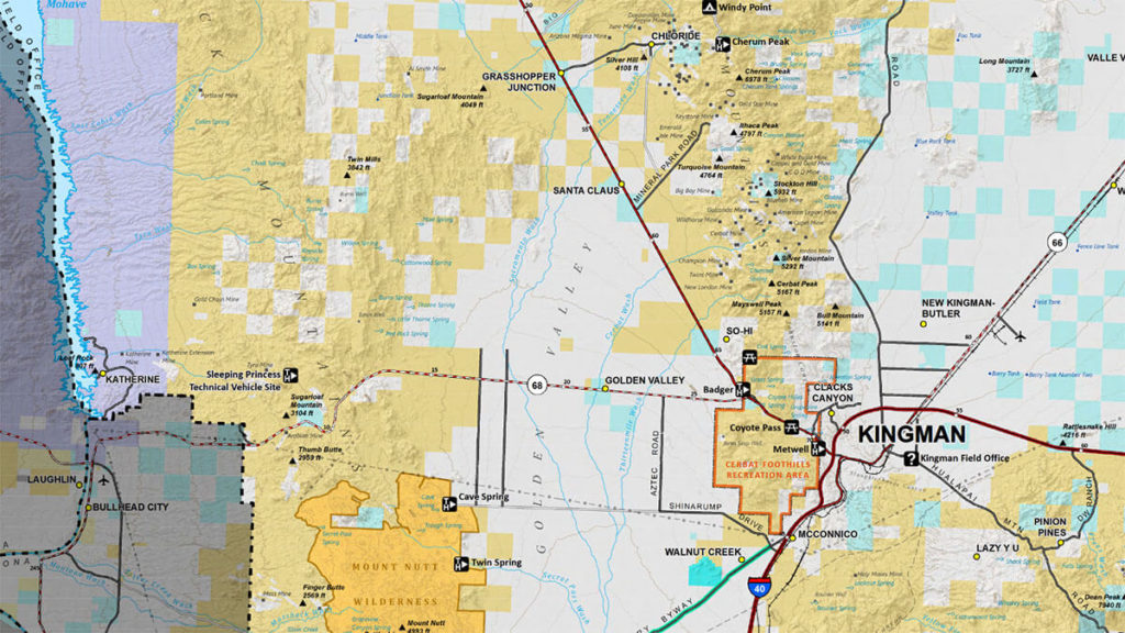
On just about all published maps that depict BLM land map overlays, BLM land is always depicted in either yellow or orange (see example above).
BLM Official Land Map Website
(Click here to access the map)
Lands shaded in yellow are BLM owned lands.
- Camping is generally allowed on BLM lands, but with certain exceptions (see BLM Camping for Free) for details.
Our Boondocking Map
Boondocker’s Bible has its own “boondocking map” that displays BLM lands in a yellow-shaded overlay. There are also overlays for USFS, NPS, and USFWS lands as well.
BLM Printed Maps
The BLM website offers access to printed maps (most of these are also downloadable in PDF)… https://www.blm.gov/maps
Keywords
blm maps, blm road maps